
Most of you, especially those in the city areas must have come across the Google Street Car, capturing your environment. Most of you most have equally wondered how these technically and technologically driven innovation works as well.
Well, the Street Car is for street mapping, defining the bird’s eye of satellite imagery. In other words, if you search your house address on Google Maps or Earth and you are able to see your street and, maybe, gate, then it’s likely one of these vehicles drove past your house or street at a point.
How does Google maps captures street views?
AI: Google Maps captures street views using a combination of technologies and vehicles, including:
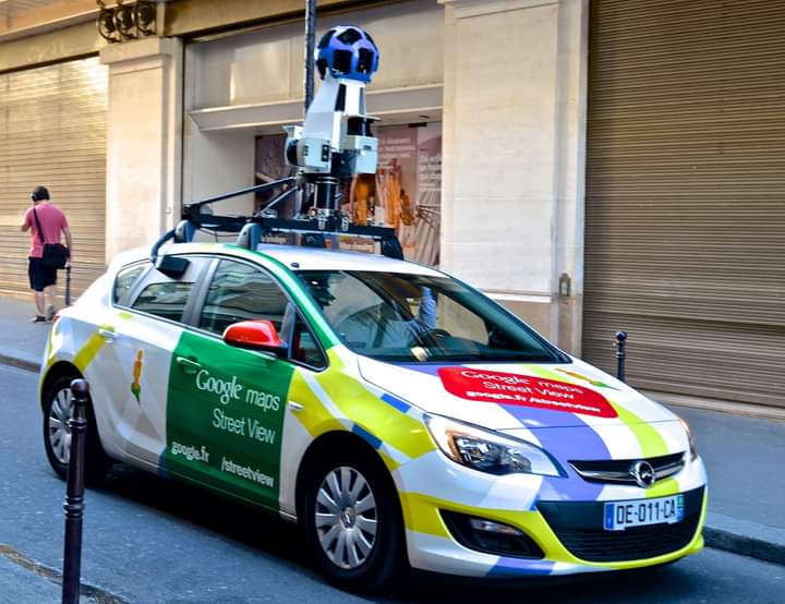
Google Street View Cars: The car as seen in this article is equiped high powered Cameras, GPS and Sensors. The Google then drives across streets and capturing 360 degree imagery.
There’s also the use of Trikes and Bicycles, basically to access areas difficult for their cars to penetrate, like parks, pedestrian areas, bike paths, etc.
There’s equally the Backpack-mounted cameras, the Operators of the cameras wear these to capture images in areas like stadium, hiking trails, and museums.
Then the Aerial Image Capturing, which involves the use of planes and satellite devices to capture aerial views to provide overhead views, context and otherwise.
The camera systems used by Google Street View Cars and equipment typically consist of the following processes:
There’s the Multi Camera Arrays, which basically captures images in multiple directions in a simultaneous manner.
Then the High Resolution Cameras, which takes the duty of capturing high quality imagery, with precise GPS supported coordinates and orientation data as well.
We equally have Lidar, Light Detection and Ranging Sensors, which focuses on helping to create a 3D point clouds, to enhance perfect and accurate mapping exercise.
Then lastly, there’s the GPS & Orientation Measurement Units, which it’s primary work is to provide location and orientation data during capturing.
At the conclusion of the above, then Google will further the exercise by processing the data collected, via advanced algorithms and computer based vision techniques. These stage will include the following;
Stitching the captured images together, by creating a seamless 360 degree panoramas.
Then further remove private Information for privacy sake. This is done by blurring some of the images captured during the exercise, which includes human faces, license plates, and several other sensitive data captured. This is inline with maintaining their privacy policy.
Then finally, the process called Geolocate images, which is simply to match images captured to specific locations on the map. In the end, we have a comprehensive, accurate and immersive street view on the Google Maps, which the world enjoys.
Meanwhile, it is worthy to mention that, Google has continued to expand its google maps data base, but continued capturing exercise.